The approaching arctic air outbreak will be the coldest air mass since February 2021.
It is forecast that temperatures will drop quickly Thursday Night into Friday Morning.
Temperatures likely to be in the teens north of Highway 105, near 20 degrees near I-10, and in the mid 20s south of I-10
Many areas could be below freezing for 20-36 hours
Many areas will likely not get above freezing on Friday.
Though warming into the upper 30s will occur on Saturday, temperatures will drop below freezing on Saturday Night/Sunday Morning
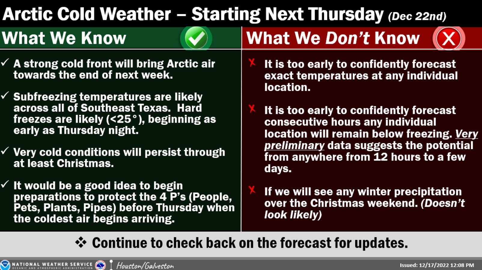
Important to Protect the Four Ps
People
Pets
Plants
Pipes
National Weather Service Information
Thursday into the Christmas Holiday
The Arctic front is on track to move into the area on Thursday. It will bring periods of freezing temperatures (and likely some <25°) into much of the weekend.
Too early to confidently pinpoint exactly just how low readings will fall, or how many consecutive hours below freezing any single location will get.
Confidence is high that we will see some bitterly cold air and freezing temperatures, but don’t focus on any individual model, or model run, this far out.
The specifics will change as time progresses.
All businesses and residents should begin preparation for some hard freezes before the coldest weather is set to move in on Thursday.
For industry that needs an extended amount of lead time, the NWS encourages individuals to review plans/actions that might need to be implemented should conditions warrant (any extended durations of subfreezing temperatures, gale force winds, high seas, low water conditions, etc.)